| | Who are the Tura?
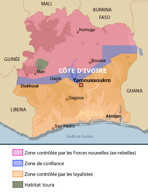
The Tura people live in a mountainous region in the western part of the Ivory Coast, located to the north of Man and 650 kilometers from Abidjan. Man is considered the "capital of the West" while Abidjan is the country's economic metropolis. The region is more specifically situated at 7-8 degrees North latitude and 7-8 degrees West longitude.
The town of Biankouma, which is the commercial and administrative center of the district with the same name, is located 40 kilometers north of Man. While the Tura territory (except its northernmost extension which belongs to Touba) is part of, the Biankouma district, the town of Blankouma is technically speaking outside of it.
The local language, Wεεn (pronounced "wεε"), also called "Tura", is spoken by about 60,000 people who are spread out among 52 villages in the area. However, a large number of Tura have moved into the urban zones in the south. Here, they have regrouped to form a multigenerational sub-community that continues to maintain social and economic ties with the Tura village communities.
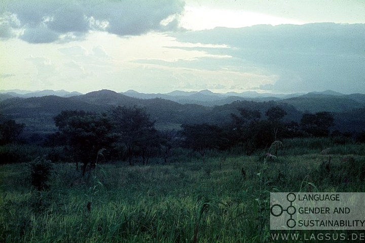
The Tura territory forms a trapezoid that extends over two climatic zones with opposing characteristics. Its southern, more densely populated mountainous part extends the dense and humid forest area which skirts the Gulf of Guinea, covering the southern half of Ivory Coast. Punctuated by the summits of the Tura Mountains rising to 1100 meters, its slopes are covered by gallery forests alternating with natural palm groves, elephant grass overgrowth, slash-and-burn subsistence agriculture (mountain rice, cassava, yams, maize; millet in the northern part) and small cash crop plantations (coffee and cocoa). Towards the north, the trapezoid includes the lower part of the Bafing River, which flows west to east before joining the Sassandra. Further north, completing the trapezoid, the Tura territory extends into the vast Worodougou plateau and forms a narrow pocket occupied by small settlements of Tura savannah dwellers: the Bõõ-mñàñàboà, survivors from the devastating raids by Samory's troops at the end of 19th century and surrounded by Manding-speaking populations with whom they live in peaceful co-habitation. Thus a natural, historical and commercial link has been formed between the core southern-bound Tura area and the Manding majority populations of Northern Ivory Coast, with whom the Tura share a good deal of common history. It is this common history, a common language, shared ecological knowledge and local narrative traditions as well as cultural and economic symbiosis of the inhabitants, both mountain and savanna dwellers, that form the basis of the territorial unity of Tura country. These factors also help integrate the contrasting physical environments into a unique and coherent human eco-system.
The economic marginalization of the Tura along with the cultural conservativism for which they are reputed are largely understandable if one considers the position of the above noted "trapezoid" relative to the great axes of commerce and traffic in the area. Its perpendicular axis is slightly inclined from southeast to northwest, with its base running parallel to the highway linking Man to Séguéla towards the east-northeast but never touching it. Its western side similarly parallels at some distance the A7, the major axis linking Man with Touba and the northernmost Ivorian city, Odienne. Moreover, until the war, this major axis was also the track linking the landlocked Republic of Mali with the modern port of San Pedro on the Ivory Coast's Atlantic shore. While the closest Tura settlements are never more than 5-10 km from the big traffic axes, the rock-scattered, rain-washed and crack-infested access roads make travel to the Tura home area a daring adventure even in normal times - let alone in a time of crisis such as this when even the annual road repair services before the coffee harvest fail to be carried out.
While the rugged topography of the Tura area constitutes an obstacle to rapid economic growth, it also offers a natural shield against invasion and war. During the recent crisis, in spite of being at the heart of the war-struck area, the Tura, in their majority, were not only spared from fighting and wanton killing but were able to offer shelter to many people fleeing the war regardless of their political and ethnic allegiances.
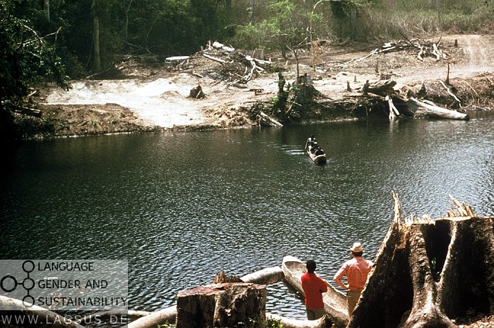
Meanwhile, however, the destabilizing effects of the crisis have brought established income-generating activities to a halt. As a meager substitute to male cash crop revenue and the sale of female gardening produce (Böni 1993), the fabrication of brooms from palm leaves has remained virtually the only source of cash revenue. Together with poaching and logging, mostly by outsiders, the quasi-industrial exploitation of the palm groves by the Tura themselves constitutes a major threat to the sustainable management of the symbiotic eco-system and to the future economic autonomy of its population. The latter, under the stress of economic regression, does not seem very aware of the long-term ecological implications affecting their future and that of their children.
Nonetheless - can a crisis of this magnitude become the source of innovative thinking? Can it motivate people to invent sustainable strategies of hope in the midst of loss and destitution? The ongoing research with the LAGSUS project seeks to find answers to this and other pressing questions. The study of local responses to such a crisis - preferably solutions negotiated through locally recognized procedures such as the Kono of the Tura (Bearth & Fan in press) - may provide elements for a development strategy adapted to peripheral, isolated regions and for comparable crisis situations, in Africa as well as in other parts of the world.
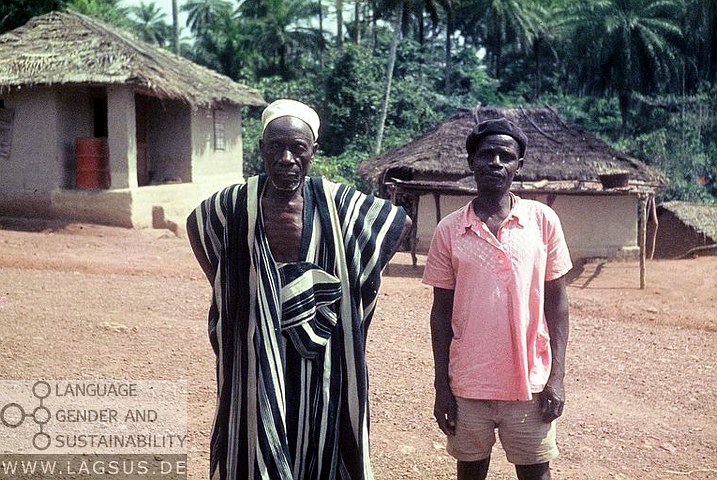
An indispensable key for sustainable answers to the crisis is local consultation involving all segments of the concerned population. Representative decisions to which all will adhere - whether they concern the clan, the village, or an associated group of villages - are taken in the palaver hut. The palaver hut represents the nerve center of the village; the place where traditional tribal wisdom and modern imported knowledge are brought together to figure out solutions to both present and future challenges.
|